
Meare and Westhay are raised up bits of land in an otherwise low lying region of marsh and boggy ground. Before the drainage canals and rhynes were built, this low lying ground would have been wet all year around, full of reeds and other light vegetation with scattered trees. Large trees tend to fall over in the boggy ground which then fall into the stagnant water and only partially decompose to peat furthering the boggy nature.
However, just to the North of the islands was a more open, deeper bit of water which stretched from near to Glastonbury to Westhay. The exact size of the lake was seasonal but around 1.5 miles long.
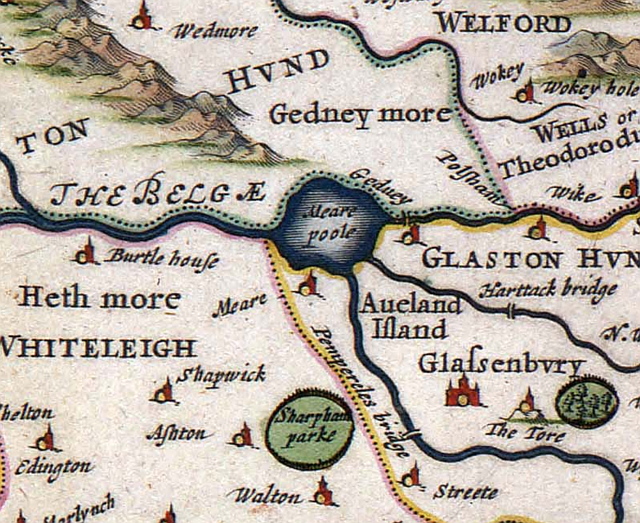
Given that fish is an important diet especially for the clergy of Glastonbury Abbey which have days of the week or Lent where no meat may be consumed, the Meare Pool was seen as a vital source of fish. It is likely that the people of Meare Lake Villages also used the lake for fish and wildfowl.
The lake was known by the name of Ferran Mere, Ferlingmere or Meare Pool. The word “mere” is old english / Saxon for lake or sea.
The lake was fed from the River Brue but the course of the river was adjusted to ensure that the lake level was kept high in the 13th century. The course of the river was also straightened from Glastonbury to Meare as a means to travel by boat directly to the manor at Meare. We still use this course today, which is the B3151 Glastonbury Road running alongside the canal.
Later on through Tudor to Georgian periods, ground was progressively drained to provide fertile soil and land for pig and cattle farming. By 1749 it does not appear on the map any more but it still floods in the area each winter.
(content: S.Edwards)